Paleotempestology of the Caribbean region: a multi-proxy, multi-site study of the spatial and temporal variability of Caribbean hurricane activity (SGP-CRA 2050)
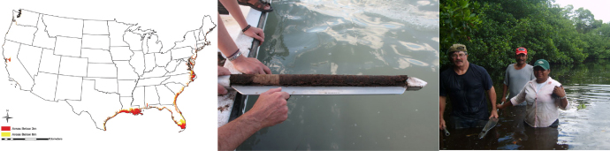
1) The map shows for the first time how many people in the U.S. coastal states live in areas below 3 meters (red areas) or below 6 meters (yellow areas) above sea level. 2) Taking sediment cores. 3) A sediment core taken from a coastal lagoon in Sian Kaan, Mexico, containing a clastic layer probably deposited by a hurricane (Photo credit: J. Donnelly).
Project information
Louisiana State University, Dept. of Oceanography and Coastal Sciences (USA)
This project follows the research started in CRN 2050, with the same title.
Executive summary
The pan-Caribbean region, which includes Central America, the Caribbean islands, and the U.S. Gulf coast, is one of the most hurricane-ridden regions of the world. In spite of the enormous damage hurricanes often inflict when making landfall, it is poorly understood how hurricane activity in this region has varied over various timescales and what controls this variability both spatially and temporally. This project analyzes the long-term variability of Caribbean hurricane activity using paleotempestology, the study of past hurricane activities, by generating and analyzing ‘proxy data’ from coastal lagoon sediments, as well as isotopic records from stalagmites, tree-rings, and corals. Recently the geographical scope of this project has been expanded to include the Pacific coast of Mexico, a region where no paleotempestology study had been done. The addition of this new study region opens the door for a comparative study in hurricane activity between two major tropical cyclone basins—the Atlantic basin and the Eastern North Pacific basin.
Goals
* Produce proxy records of past hurricane activity in the Caribbean region and the Pacific coast of Mexico
* Understand the climate mechanisms that affect Caribbean hurricane activity by analyzing and modeling historical hurricane records and modern climate data
* Use past records to assess the risk of future hurricanes
Some results
A new coral-based proxy record of Atlantic sea surface temperatures for the period AD 1552-1991, the longest-ever established, shows that higher hurricane activity before 1550 and after 1750 coincides with warmer sea surfaces. When the Atlantic surface was cooler, there were fewer storms in the Caribbean.
The spatial distribution of lightning is different between cyclones that have mostly westward tracks (lower rates and more in the inner core, within 100 km of radius) than the ones with trajectories that re-curve and make landfall in the mainland. Cyclones in the latter category show more lightning in the outer bands (between 300 and 400 km from the eye) and in the quadrant closer to land.
Caribbean hurricane activity varies following climate patterns such as the Atlantic Multidecadal Oscillation (AMO) and El Niño-Southern Oscillation (ENSO). Proxy data and modeling reveal peaks in Atlantic hurricane activity during Medieval times (AD 900-1100), and again since 1980, can be explained by the prevalence of warmer sea surface temperatures and La Niña-like conditions.
New proxy records from Nicaragua and Belize reveal an anti-phase relationship in hurricane landfall activity between Central America and the eastern Caribbean and U.S. East coast, suggesting that shifting positions of the ITCZ (inter-tropical convergence zone) and the subtropical anticyclone and the resultant changes in steering patterns may be important factors affecting coastal hurricane risks in the western Atlantic.
Air mass circulations in the Intra-Americas Sea are dominated by the Low-Level Jet (IALLJ). A re-analysis of the Jet shows that it critically affects sea surface temperatures and moisture advection – important factors for hurricane strength and storm damage.
Geographical and demographic (2006) data show approximately 19 million people living within vulnerable areas less than 1 km from the coastline in the conterminous U.S. and 12 million people live within three-meter elevation along the coast.
Hurricane or Tsunami? An Extreme Event that Hit the Pacific Coast of Baja California Sur, Mexico, ca. 500 Years Ago
Kam-biu Liu 1, Thomas Bianchette 1, Terrence McCloskey 1, Shichen Tao 1, Qiang Yao 1, Luis M. Farfan 2, Graciela B. Raga 3
1. Department of Oceanography & Coastal Sciences, Louisiana State University
2. CICESE, Unidad La Paz, BCS, Mexico
3. Centro de Ciencias de la Atmosfera, UNAM, Mexico
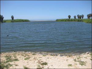
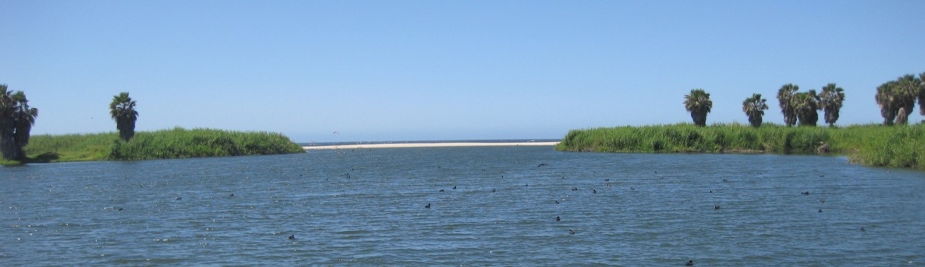
Laguna La Poza, a freshwater backbarrier lake in Baja California Sur,
yield sedimentary evidence of an extreme event that hit Baja California Sur ~500 years ago.
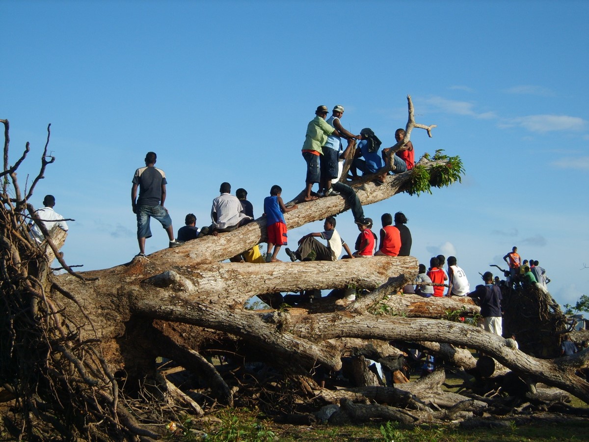
Members of Dr. Liu’s term doing paleotempestology fieldwork in the remote Mosquito Coast of Nicaragua, with the help of local residents
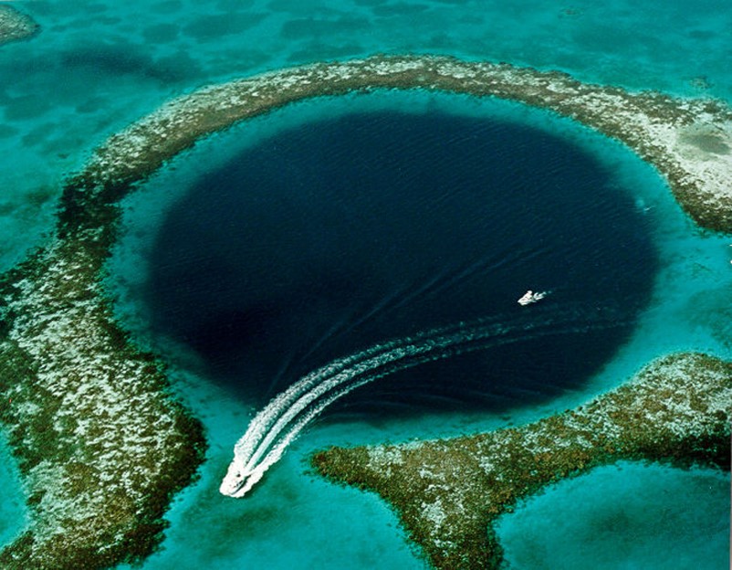
Aerial photo of the Blue Hole from the Society for Sedimentary Geology photo archive. The cores in this report were taken near the center of the Blue Hole. Photo credit: SEPM. We already obtained permission from SEPM if we want to publish this photo.
Blue Hole
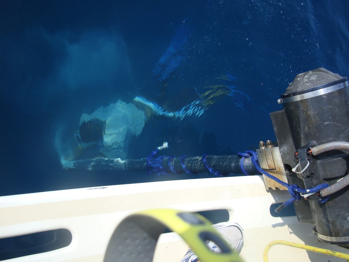
Captain Tony: Our captain for Guerrero Charters capping the base of the 7-m core barrel to prevent core loss. (Photo credit: Sam Bentley, CRN2050)
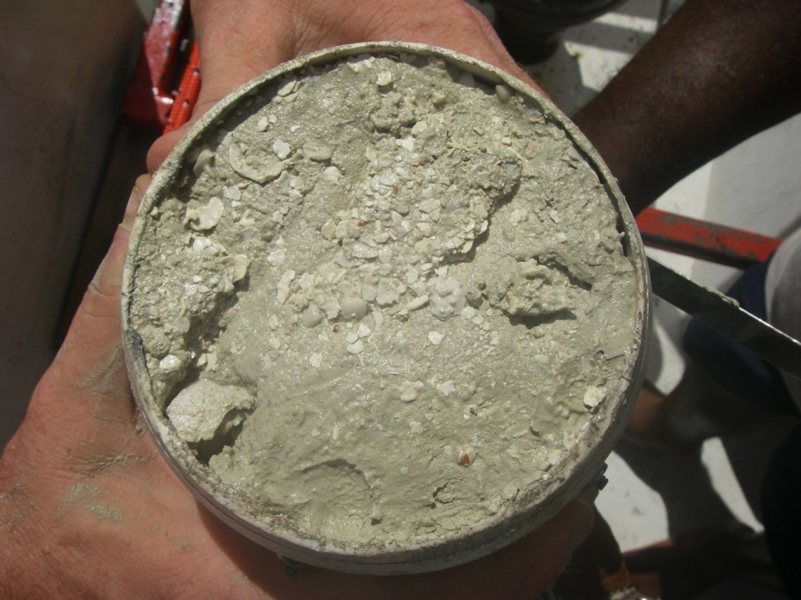
Blue Hole: Field photo of the bottom of a gravity core, subbottom depth about 70 cm. The core penetration was stopped by a prominent coarse-grained event layer, deposited by a hurricane ca. 1936. (Photo credit: Sam Bentley, CRN2050)
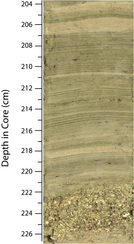
Blue Hole vibracore
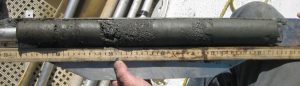
This image is a high-resolution digital image of a vibracore from the Blue Hole used for extracting varve and event-layer bed depths. Fair-weather sediments are composed of alternating layers of greenish carbonate mud deposited during the annual wet season, and cream-colored mud deposited during the dry/trade wind season. The prominent coarse layer near 224 cm depth was deposited by a hurricane in the Blue Hole ca. 1369 AD, during the transition from the Medieval Warm Period to the Little Ice Age.
Project investigators
Kam-biu Liu (kliu1@lsu.edu)
Louisiana State University, Dept. of Oceanography and Coastal Sciences (EE.UU.)
Nina Lam (Louisiana State University, EEUU)
Amy Frappier (Skidmore College, EEUU)
Claudia Mora (University of New Mexico, EEUU)
Jeff Donnelly y Anne Cohen (Woods Hole Oceanographic Institution, EEUU)
Sam Bentley (Memorial University of Newfoundland, Canadá)
Matthew Peros (Bishops University, Canadá)
Jorge Sanchez-Sesma (IMTA, México)
Jorge Amador y Eric Alfaro (University of Costa Rica, Costa Rica)
Students
Aaron Muñoz Vega, grado, Universidad de Costa Rica, Costa Rica.
Alberto Salazar Murillo, grado, Universidad de Costa Rica, Costa Rica.
Alejandro Meza, grado, Universidad de Costa Rica, Costa Rica.
Crawford White, doctorado, Louisiana State University, EEUU.
Dustin Naquin, maestría, Louisiana State University, EEUU.
Elsie Troyo López, grado, Universidad de Costa Rica, Costa Rica.
Esteban Pérez Hidalgo, grado, Universidad de Costa Rica, Costa Rica.
Esteban Rodríguez Betancourt, grado, Universidad de Costa Rica, Costa Rica.
Ingrid L. Rivera Arrieta, grado, Universidad de Costa Rica, Costa Rica.
Kenan Li, doctorado, Louisiana State University, China.
Lei Zou, doctorado, Louisiana State University, China.
Melvin G. López Moreira, grado, Universidad de Costa Rica, Costa Rica.
Nicholars Janzen, doctorado, Louisiana State University, EEUU.
Pablo Ureña Mora, grado, Universidad de Costa Rica, Costa Rica.
Paula Pérez Briceño, grado, Universidad de Costa Rica, Costa Rica.
Qiang Yao, doctorado, Louisiana State University, China.
Rebeca Sura Fonseca, grado, Universidad de Costa Rica, Costa Rica.
Tom Bianchette, Post doctorado, Louisiana State University, USA.
Yi Qiang,Post doctorado, Louisiana State University, China.
Yuliana Pacheco Retana, grado, Universidad de Costa Rica, Costa Rica.
